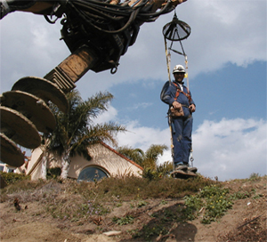
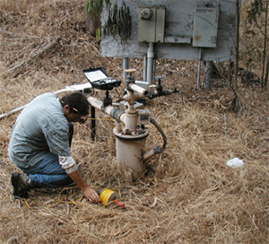
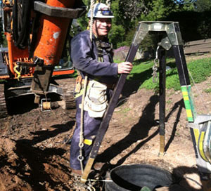
Larry D. Gurrola, Ph.D.
Professional Geologist No. 7865
1631 Calle Canon
Santa Barbara, California 93101
Phone: 805-563-5797
Cell: 805-886-4607
E-mail: lg@larrygurrola.com
_____________________________________________________________________
Providing Expert Consulting and Contract Services for
Professional Geologists, Certified Engineering Geologists, Geotechnical Engineers, and Certified Hydrogeologists
____________________________________________________________________

____________________________________________________________________
Data Collection & Data Processing Services Including:
Aerial Photograph and Geologic Hazards Mapping
Quaternary Chronology
Fault Activity Assessment and Landslide Evaluation
Soil, Tectonic, and Fluvial Geomorphiology
Geographic Information Systems
Downhole Logging and Soil Sampling
Air, Groundwater, and Environmental Sampling
Site History Research
Drafting and Publishing
_____________________________________________________________________


_____________________________________________________________________
Related Projects
_____________________________________________________________________
| Date | Project | Tasks | Company |
| July 2007 | Fault Investigation Proposed Development, Goleta, California | Fault Evaluation of an Unnamed Fault and Establish and Quaternary Chronolgy. | GMU Geotechnical, Rancho Santa Margarita, California |
| January 2006 | Fault Investigation for Proposed Development, Los Angeles, California | Fault Evaluation of a strand of the Newport-Inglewood fault zone, | John Helms, Palmdale, California |
| January 2006 | Fault Investigation for Proposed Subdivision, Camarillo, California | Fault Evaluation of the Springville Fault zone. | Earth Systems, Inc., Ventura Office |
| November 2005 | Sea Cliff Stability and Landslide Evaluation, Arroyo Quemada Lane, Gaviota, California | Landslide mapping, downhole logging, and sea cliff retreat investigation; and drywell testing for septic system. | Michael F. Hoover, Santa Barbara, California |
| Nov. 2005 to present | Rancho Monte Alegre, Carpinteria, California | Geologic hazards evaluation | Earth Systems, Inc., Ventura Office |
| Aug.-Oct. 2005 | 7-11 at Carmen Dr., Camarillo, California | Fault Evaluation | Earth Systems, Inc., Ventura Office |
| March-April 2005 | Landslide Mapping and Evalution of 4-Parcels, Sulfur Mountain, Ojai, California | Aerial photo mapping, geologic mapping, downhole and test pit logging. | Earth Systems, Inc., Ventura Office |
| September 2004 | Fault Study for Residential Remodel | Determine activity of the Ventura fault and determine slip per seismic event. | Earth Systems, Inc., Ventura Office |
| August 2004 | Camarillo High School Bleachers | Fault evaluation for proposed stadium bleacher expansion. | Earth Systems, Inc., Ventura Office |
| February-March 2004 | Tract 3634; Proposed 73-Unit Subdivision, Santa Paula, California | Landslide evaluation, geologic mapping, downhole and test-pit logging. | Earth Systems, Inc., Ventura Office |
| January 2004 | Rancho Tajiguas; Proposed 4-Lot Developments | Landslide evaluation, geologic mapping, downhole logging, and drywell testing for septic system. | Michael F. Hoover, Santa Barbara, California |
| December 2003 | Sheffield Reservoir Fault Study, Santa Barbara, California | Evaluation for the presence and location of the Mission Ridge fault. | Fugro West, Inc., Santa Barbara, California |
| October 2003 | Report of Waste Discharge; Chicago Grade Landfill, Atascadero, California | Soil sampling and site geology | Michael F. Hoover, Santa Barbara, California |
| March 2003 | Santa Barbara Cottage Hospital; Geologic and Geomorphic Study, Santa Barbara, California | Geomorphic evaluation of a mapped, unnamed fault underlying proposed building | Fugro West, Inc. Ventura, California |
| February 2003 | Report of Disposal Site Information, Atascadero, California | Site geology | Michael F. Hoover, Santa Barbara, California |
| Jan. 2002 - April 2003 | Storm Water Sampling and Quarterly Monitoring; Santa Maria Transfer Station and Chicago Grade Landfill, Atascadero, California | Storm water sampling, site inspection, and quarterly groundwater sampling. Data and report preparation for the semi-annual monitoring reports. | Michael F. Hoover, Santa Barbara, California |
| April 2002 | Fault Activity Investigation; Chicago Grade Landfill, Atascadero, California | Fault investigation to determine the location and the recency of faulting of an unnamed fault using soil-age dating. | Michael F. Hoover, Santa Barbara, California |
| May 2000 | Ranchito Vista Road Replacement Water Pipeline, Santa Barbara, California | Geologic hazard mapping and landslide hazards investigation | Fugro West, Inc., Santa Barbara, California |
_____________________________________________________________________


_____________________________________________________________________
Tribute to Tom Dibblee, Jr.
_____________________________________________________________________
| Santa Barbara Independent newspaper article by Larry Gurrola - Download article |

_____________________________________________________________________
La Conchita Megaslide Research
_____________________________________________________________________
| Project | Description | Link |
| Digital Elevation Model No. 1 | Digital Elevation Model (DEM) of Rincon Mountain and La Conchita, California by Tim Tierney (www.cartograph.com) | Map file - pdf |
| Digital Elevation Model No. 2 | Digital Elevation Model (DEM) of Rincon Mountain and La Conchita, California | Map file - pdf |
| Geology Paper | Landslide Hazards in the Modern Landscape; La Conchita, California - in review | |
| Preliminary Geologic Map | Geologic Map of the Rincon Mountain Area including Carpinteria, La Conchita and Mussel Shoals (1:6,000) - in draft. | |
| Technical Summary Report | Summary of all geologic data and maps for La Conchita, California - in prep. | |
| Geologic Society of America Presentation | Powerpoint presentation of the La Conchita abstract, Salt Lake City, Utah. | Ppt file |
| Geologic Society of America Abstract | Prehistoric Landslide Complexess in the Landscape and Associated Hazards; La Conchita, California. Presented at the Geological Society of America Conference, Salt Lake City, Utah on Oct. 19, 2005. | Abstract - pdf |
| UC Santa Barbara Press Release | "Geologists Say La Conchita Landslide is Part of a Larger Prehistoric Slide" Oct. 19, 2005 | Press Release |
_____________________________________________________________________
Santa Barbara Ph.D. Research Map Products
_____________________________________________________________________
| Active Tectonics and Earthquake Hazards Evaluation of the Santa Barbara Fold Belt | Dissertation File as PDF (Please contact me for a CD-rom) |
| Santa Barbara and Carpinteria Coastal Plain | Goleta and Dos Pueblos Coastal Plain |
|
1:24,000 map of the geology of the Santa Barbara coastal plain. Shows the location of cross-section A-A' . |
1:24,000 map of the geology of the coastal plain of the Goleta-Dos Pueblos area. |
|
1:24,000 map of the Santa Barbara coastal plain showing late Pleistocene marine terrace and alluvial fan deposits. The geologic units and tectonic geomorphology is overlain on a 3 m DEM generated from Santa Barbara County Flood Control topographic data. |
High-resolution file of a1:24,000 map of the Goleta and Dos Pueblos area shows the tectonic geomorphology and the pre-Quaternary and Quaternary geology overlain on a 3-meter DEM. The DEM was generated from Santa Barbara County Flood Control topographic data. |
| Geologic Cross-Section A-A' showing subsurface geology beneath downtown Santa Barbara. | Subsurface Map of the Base of 47 ka MarineTerrace Deposits, University of California, Santa Barbara - Subsurface map of the marine terrace - Sisquoc Formation contact generated from geotechnical borings and test-pits data. Data provided by Bill Hanna, UCSB Facilities and Planning Management. |
| Geologic and geomorphic mapping from Carpinteria to Mussel Shoals, California - In colloboration with the U.S.G.S BALANCE RESEARCH GROUP | Mapping in progress by Gurrola. |
_____________________________________________________________________
Published Map Products
_____________________________________________________________________
| Final geologic map of the Santa Barbara, Carpinteria, and Goleta area, Santa Barbara County, California | Geologic mapping of the coastal plain from El Capitan to Rincon Point, Santa Barbara County - in press. |
| 2002 Preliminary geologic map of the Santa Barbara Coastal Plain area, Santa Barbara County, California by Minor, Kellog, Stanley, Stone, Powell II, Gurrola, Selting, and Brandt. | Download maps - geologic map of the coastal plain from Goleta to Summerland, Santa Barbara County, California |
_____________________________________________________________________
Ventura County Research Map Products
_____________________________________________________________________
| Geologic and geomorphic maps of the Ojai and upper Ojai Valley, California | In progress |
| Geologic map of the Rincon Mountain area, Ventura County, California | In progress |


_____________________________________________________________________
Abstracts, Publications, and Field Trip Guidebooks of the Santa Barbara Fold Belt
_____________________________________________________________________
| 2005 Geologic Society of America Cordilleran Section Meeting, Salt Lake City, October 2005 | Prehistoric Landslide Complexess in the Landscape and Associated Hazards; La Conchita, California by L. D. Gurrola and E. A. Keller |
| 2005 Association of Engineering Geology, Southern California Section - La Conchita Landslide | Role of Large Landslides in Landscape Evolution and the Associated Hazards: Example of La Conchita, California |
| 2004 Friends of the Plestocene Field Trip Guidebook | Please contact me for a guidebook. |
| Abstracts on Earthquake Geology in Reverse-Faulting Terrains - 2003 Geological Society of America Conference | Earthquake Geology Abstracts |
| Tectonic Geomorphology, Active Folding, and Earthquake Hazard of the Mission Ridge Fault System, Santa Barbara, California - 2003 Geological Society of America Conference - Cordilleran Section | Abstract - pdf file |
| 2003 Southern California Earthquake Center Annual Meeting Field Trip Guidebook - Abridged guidebook with four field trip stops including Santa Barbara Point, Santa Barbara Cemetery anticline, Loon Point anticline, and Carpinteria Railroad fault. | Field Trip Guidebook - pdf file |
_____________________________________________________________________
GIS, Digitial Elevation Models, 3-D Hillshade Visualizations
_____________________________________________________________________
| Digital elevation model of eastern Sulfur Mountain, Ojai, California | View example |
| Digital elevation model of the Santa Barbara Mission scarp, Santa Barbara, CA. View azimuth is 30 degrees and view is looking to the southeast. | View example |
| Digital elevation model of the Santa Barbara Mission scarp, Santa Barbara, CA. View azimuth is 20 degrees and view is looking to the west. | View example |
| Subsurface Map of the 45 ka UCSB Campus Terrace Platform, University of California, Santa Barbara, CA | View Example |
| Digital elevation model of the south-facing scarp at Foothill and Alamar Roads, Santa Barbara, CA | View Example |
_____________________________________________________________________
Past Field Trip and Society Meeting Presentations
_____________________________________________________________________
| 2006 Coast Geological Society, Ventura, California, September 19, 2006 - Rincon Mountain Megalandslide, Ventura County, California |
| 2005 Association of Engineering Geology Society Meeting, Central California Section August 31, 2005 - Presentation on "La Conchita Landslide and Associated Hazards, Ventura County, California |
| Coast Geological Society Field Trip, Ventura, California October 22, 2005 - La Conchita field trip stop by L. Gurrola and E. Keller. Website information at: www.coastgeologicalsociety.org |
| Friends of the Pleistocene Pacific Cell on April 15-18, 2004 in Santa Barbara, California. Field Trip Information: Website Information and Announcement |
| 2002 South Coasts Geological Society "Structural Geomorphology, Petroleum and Water Resources, Northwestern Transverse Ranges"; Santa Barbara Field Trip Stops by L. Gurrola |
_____________________________________________________________________
Future Research and Mapping Projects
_____________________________________________________________________
| Geologic and landslide hazards of the Rincon Mountain area, Ventura County | In draft |
| Geomorphic and geologic map of the Ojai and upper Ojai Valleys, California | In progress |
| Paleoseismology of the central branch of the Red Mountain fault zone, Ventura County, California | Preliminary fault activity study to determine Holocene and late Pleistocene seismicity of the central strand of the Red Mountain fault zone, western Ventura County, California. Fault trenches will be excavated in late September in order to identify potential trench-sites where detailed stratigaphic, chronologic, and seismic data can be collected to assess earthquake hazard. |
| Marine terrace mapping and chronology from Goleta to Point Conception, California | Aerial photograph and field-mapping of the tectonic geomorphology westward from the UC Santa Barbara and Ellwood area to the Point Conception area, California |
| Geologic mapping of the eastern Carpinteria, Pitas Point and White Ledge Peak quadrangles, Santa Barbara and Ventura Counties, California | Geologic and geomorphic mapping along the Arroyo Parida and Red Mountain fault zones with emphasis on Quaternary geology and structure. |
_____________________________________________________________________
Educational Power Point Lectures
_____________________________________________________________________
| Winter Quarter 2006 UC Santa Barbara | GS 20 Geologic Hazards - Landslides lecture | Landslides Lecture |
| Summer Session 2003, UC Santa Barbara | GS1 Environmental Geology - Undergraduate-level environmental geology class designed for non-majors | www.geol.ucsb.edu/projects/gs1 |
| Spring 2004, UC Santa Barbara | GS 134 Engineering Geology |
_____________________________________________________________________
Public Outreach
| List of Scientific Public Outreach | Table format as pdf file |
_____________________________________________________________________